


Whitesville-Berkeley Voting District, Berkeley County, South Carolina
About
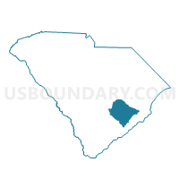
Outline

Summary
| Unique Area Identifier | 665173 |
| Name | Whitesville-Berkeley Voting District |
| County | Berkeley County |
| State | South Carolina |
| Area (square miles) | 24.49 |
| Land Area (square miles) | 24.20 |
| Water Area (square miles) | 0.30 |
| % of Land Area | 98.78 |
| % of Water Area | 1.22 |
| Latitude of the Internal Point | 33.12546680 |
| Longtitude of the Internal Point | -80.04011610 |
Maps


Graphs
Select a template below for downloading or customizing gragh for Whitesville-Berkeley Voting District, Berkeley County, South Carolina


Neighbors
Neighoring Voting District (by Name) Neighboring Voting District on the Map
- Boulder Bluff No. 2 Voting District, Berkeley County, SC
- Carnes Crossroads No. 1 Voting District, Berkeley County, SC
- Cordesville Voting District, Berkeley County, SC
- Moncks Corner No. 2 Voting District, Berkeley County, SC
- Moncks Corner No. 3 Voting District, Berkeley County, SC
- Moncks Corner No. 4 Voting District, Berkeley County, SC
- Pimlico Voting District, Berkeley County, SC
- Pinopolis Voting District, Berkeley County, SC
- Wassamassaw No. 1 Voting District, Berkeley County, SC
Top 10 Neighboring County Subdivision (by Population) Neighboring County Subdivision on the Map
- Goose Creek-Hanahan CCD, Berkeley County, SC (114,128)
- Moncks Corner CCD, Berkeley County, SC (22,729)
- Cordesville CCD, Berkeley County, SC (4,016)
Top 10 Neighboring Place (by Population) Neighboring Place on the Map
Top 10 Neighboring Unified School District (by Population) Neighboring Unified School District on the Map
Top 10 Neighboring State Legislative District Lower Chamber (by Population) Neighboring State Legislative District Lower Chamber on the Map
- State House District 117, SC (44,750)
- State House District 102, SC (37,248)
- State House District 100, SC (34,763)
Top 10 Neighboring State Legislative District Upper Chamber (by Population) Neighboring State Legislative District Upper Chamber on the Map
Top 10 Neighboring 111th Congressional District (by Population) Neighboring 111th Congressional District on the Map
Top 10 Neighboring Census Tract (by Population) Neighboring Census Tract on the Map
- Census Tract 207.07, Berkeley County, SC (5,491)
- Census Tract 205.06, Berkeley County, SC (5,380)
- Census Tract 206, Berkeley County, SC (5,230)
- Census Tract 205.03, Berkeley County, SC (5,188)
- Census Tract 204.01, Berkeley County, SC (4,016)
- Census Tract 205.04, Berkeley County, SC (3,989)
- Census Tract 207.12, Berkeley County, SC (3,415)
- Census Tract 205.05, Berkeley County, SC (2,942)
- Census Tract 207.11, Berkeley County, SC (2,720)